
Vous n‘avez pas encore ajouté de fiche à vos favoris.


Ajouter aux favoris
Sport
Alpine hike: Pas de l'Ours Trail
Galerie
Description
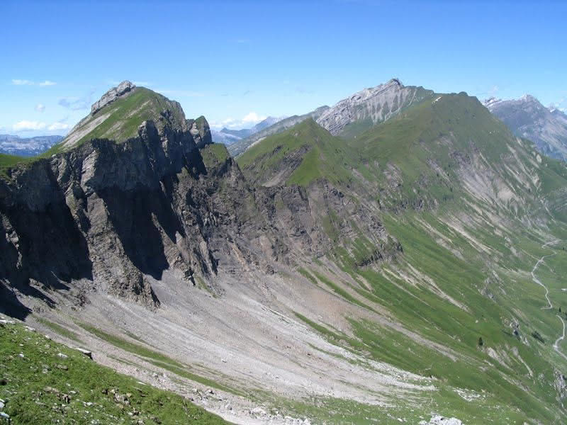
Along the whole length of the trail you will overlook impressive mountain cliffs and see the Route des Montagnes and Col de l'Arpettaz 900m below your feet. The trail takes you to the summit of Mont-Charvin, the highest point of which is at 2409 m.
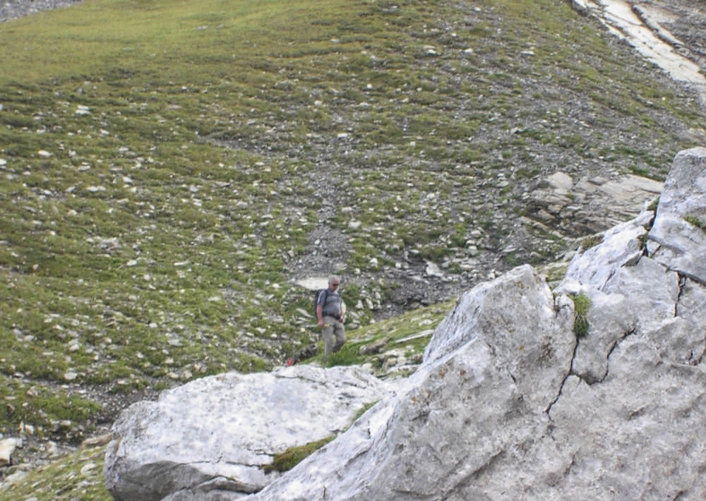
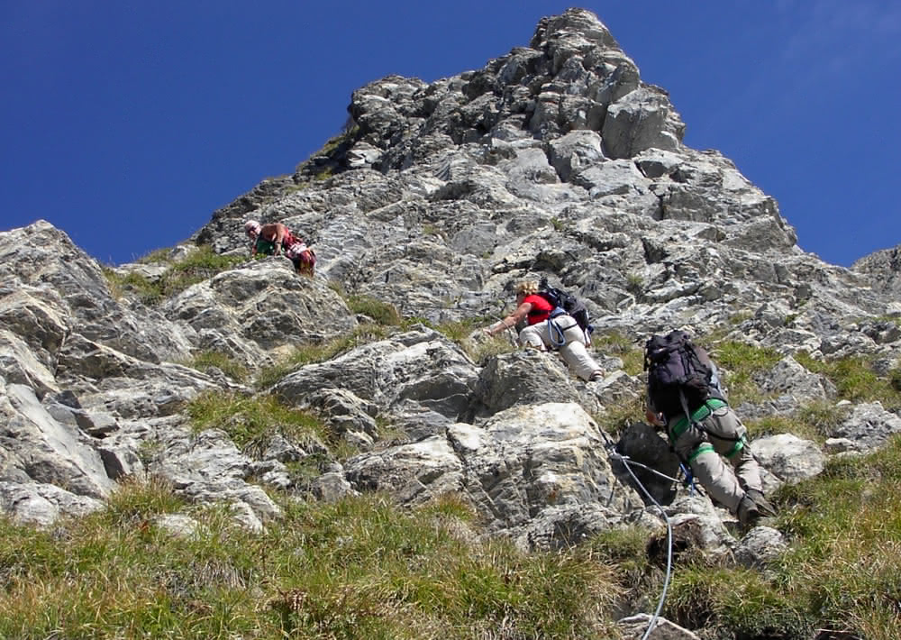
Cabled trail of Le Pas de l'Ours :
From the town of Ugine, take the road that goes to the Col de l’Arpettaz, then follow the Route des Montagnes d’Ugine up to the Chalet de Merdassier du Milieu at an altitude of 1585 m. Park your car in the car park. From the Chalet de Merdassier du Milieu, you are at the start of a footpath which runs along the ridge linking the Tête de l’Aulp with Mont-Charvin taking approximately 1 ½ hours. A natural passage, the Mène Noire is a steep rocky section between a band of shale and limestone. Follow it for 250 m over a trail that is equipped with steel cables before coming out on the higher ridge of Mont-Charvin, with views over the Alps and from where you overlook the Manigod valley, not far from the Lac du Charvin. As you climb up the fairly exposed ridge, you reach the summit at 2409m, bordered to the South by rock faces. From the summit you will have a magnificent panoramic view over the whole of the Northern Alps as well as the Mont-Blanc and Beaufortain mountain ranges. Go back down via the same itinerary.
Ouverture
From 06/15 to 10/15.
Subject to favorable weather.
Tarifs
Gratuit
Infos complémentaires
- Équipements : Parking
- Animaux acceptés : Non
- Type de parcours : Aller-retour
This can interest you
- Parking
- Animaux acceptés
- Terrasse
Refuge-auberge du Col de l'Arpettaz
The mountain refuge and restaurant in the Col de l'Arpettaz propose local food and gourmet snack. The restaurant carte ...
Ugine